Your Online Trail Report and Travel Guide for ATVs the U.S. & Canada
Your Online Trail and Travel Guide for ATV the U.S. & Canada

Reporter Areas

Iron Mountain, Michigan


Area Information

Order your FREE Visitors Guide & ATV Trail Map! – CLICK HERE


Iron Mountain and the Dickinson County area, in Michigan’s Upper Peninsula, offer many opportunities for ORV/ATV riders. Whether it is on a state-designated trail, forest road or shoulders of county roads, the county offers a wide range of trail conditions and spectacular scenery.

Trails and roads wind through forested areas, across creeks, and near lakes and rivers. Some will travel on railroad grades for cruising; others will traverse over rougher terrain for the adventurous types. Most of the trails are actually unpaved county roads. Because of the many years of previous mining or timbering, these roads are permanent roads that traverse across the entire county. This opens up literally hundreds of miles of riding. Whether you are looking for a comfortable and scenic cruise or an adventurous backwoods romp, the ORV/ATV trails in the Dickinson County area can fulfill your needs.
 

Most trails are just a short transport from local hotels and restaurants. From small, friendly, locally owned and operated motels, to national chain hotels, lodging in the area also have variety. Wonderful food can be had ranging from take-out, delivery, casual and fine dining. Everything from mouth-watering steaks to homemade Italian dishes can tantalize everyone’s tastes.

 
If you would like more information on how to ride the trails in Dickinson County, please contact the Dickinson Area Partnership at 1-800-236-2447 or www.ironmountain.org. We have riding guides available, but we are currently updating our maps, guides and signage for the available riding areas.

Click Here to see where Iron Mountain / Dickinson County, MI is located

Click Here to see the current weather forecast for Iron Mountain / Dickinson County, MI.


Gogebic & Ontonogon County, Michigan


Area Information

CLICK HERE for Lake Gogebic, Michigan Lodging Info!


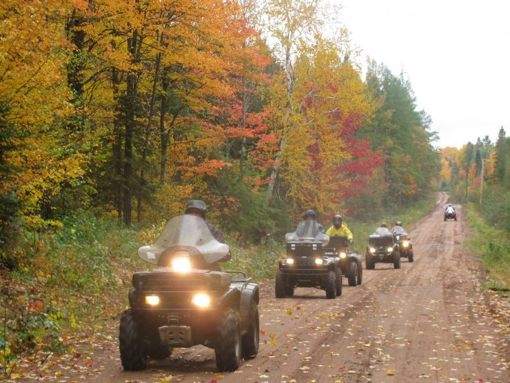
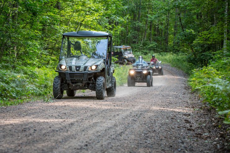
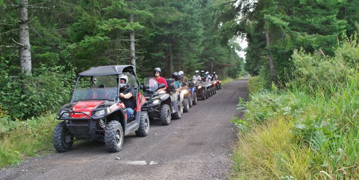
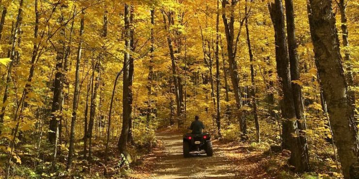
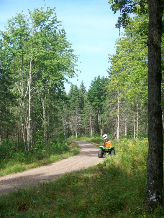
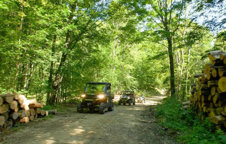
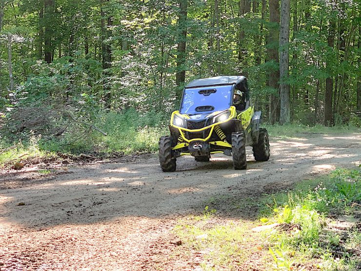
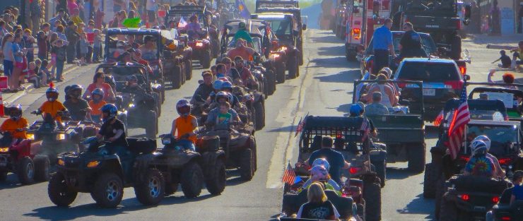
Riders can enjoy seemingly endless trails and forest roads through the scenic wilderness of the U.ATVing the Western Upper Peninsula of MichiganP.’s national and state forest lands. The Western Upper Peninsula of Michigan offers off-road enthusiasts nearly infinite riding possibilities, with hundreds of miles of scenic and historic trails.

The Bill Nichols Trail begins in Greeland in Ontonagon County and travels northwest for 35 miles to south of Houghton. Riders will enjoy an exciting trek across the Fire Steel Bridges; each trestle is well over 100 feet above the river!

Another route, the Hancock-Calumet, is a fun-filled trip between the two cities. An abandoned railroad grade from Iron River east to Watersmeet and on to Marenisco provides riders with a nearly 80-mile journey.

MICHIGAN’S UPPER PENINSULA’S MULTI-USE TRAIL SYSTEM

Imagine a multi use trail system that was built with the services and cooperation of the Michigan National Guard, U.S. Army Reserve, U.S. Forest Service, Michigan Department of Natural Resources, corporations and private landowners, and you can well imagine the magnitude of one of the largest multi use trail projects in the Midwest. A truly remarkable cooperative effort between Federal, State, and Local authorities, itis a National Role Model project coordinated by the Ontonagon County-based organization of Trails and Recreation Alliance of Land and the Environment of the Upper Peninsula, better known as TRALE-UP.

TRALE-UP was founded in the early 90’s by a group of ATV enthusiasts. Originally called the Ontonagon County ATV Club, the clubs founding members organized to ensure that the thousands of acres of Federal and State land would remain open to ATV’s In the Western Upper Peninsula, ATVs are the preferred mode of transportation to get to and from deer camps, stand, and blinds. Thus, it was important that ATV travel continue to be permitted on public land.ATVing the Western Upper Peninsula of Michigan

From securing ATV access to public lands to building a multi-use trail system, the driving force behind TRALE UP has been President Jim Firkus.  As the organizations “founding father”, Firkus has been the key to the success of bringing Federal, State, and Local Government as well as private parties together for the benefit of ATV riders.

“If the National Guard and the Reserve wants and needs the experience of building a road in the middle of nowhere, I know exactly where and how they can get that valuable training. By working with TRALE-UP, they’ll get the training and we’ll get their expertise, equipment, and most of all, the workers!” commented Firkus.

“The Guard and Reserve used their summer training in building roads, bridges, and laying culverts.  Everything they did was with the cooperation of the Forest Service and DNR  After all, these roads will become environmentally friendly multi-use trails that generations will be able to use and enjoy for many, many years.” Per Firkus.

The multi-use trail system has been planned to incorporate one of the nation’s must scenic areas, Ontonagon County, along with the region’s rich mining history. The trail system leads the ATV enthusiast to remote mining areas of the later 1800’s and early 1900’s. The trail system also features rest and picnic areas, and interpretive geographic and historical trails.

If this isn’t enough to show you why Ontonagon County’s multi-use trail system has generated the interest of people all over the U.S., read on.

With the help of the R.L. Ryerson Company and Polaris, TRALE-UP has been working with the organization Outdoors Forever. Outdoors Forever is a Michigan-based organization that works with different public and private organizations in building off road access areas for the physically challenged. An organization that has been an instrumental part of the planning and development of many facets of this multi-use trail system.

TRALE-UP President Firkus once again led the way in providing access for the physically challenged by building a wheelchair-accessible overlook to the remote Agate Waterfalls in Southern Ontonagon County, along with the beautiful “Deer Marsh” area in Baraga County.

According to Firkus, the R.L. Ryerson Company and Polaris not only provided ATV’s to be raffled off but also a Big Boss 6 Wheeler that was used to bring in tons of rock and other materials to build these sights for Outdoors Forever.

Ontonagon County’s multi-use trail system plans on linking up with the hundreds of miles of pre-existing multi-use trails, trails that include the use of numerous abandoned railroad beds and trestles. It is a trail system that has been built to be environmentally friendly.

Per TRALE-UP member Skip Schultz, “The trail system has more culverts to correctly move and drain water than the City of Milwaukee. It is amazing to see how much long range planning has gone into this trail system. The last thing TRALE-UP wanted was for someone to say we are hurting the beauty of the Western U.P.

From bluffs that overlook thousands of acres, to trails that wind through virgin forests, here is an ATV enthusiast’s ultimate destination. Ontonagon County recognizes the value of the growing ATV community as a valuable tourist attraction.

Before traveling in the Upper Peninsula please be sure to check the area maps that show routes and trails to be sure they are designated ATV trails.


Spooner / Washburn County Wisconsin

Trail Conditions: Excellent

Date of Report: May 30, 2024

Area Report:

All Washburn County ATV/UTV Trails are officially open for the season. There is continued trail maintenance throughout the season to keep all trails in good riding conditions so ride with caution, tread lightly, and stay on designated trail surfaces.  Please note, the fire danger in Washburn County continues to fluctuate often – if the fire danger reaches levels of Very High or higher all trails will automatically close per county statute. To stay up to date on the current WI Fire Danger postings, please click here. 

Should you encounter any trail washouts, downed trees, or other trail issues please be report those to Washburn County Forestry at 715-635-4490. 


Area Information

For your FREE Trail Map and Visitor Guide, call 800-367-3306 
or
CLICK HERE for your FREE trail map! 
Visit us at
www.washburncounty.org for more information.


OVER 100 MILES OF SCENIC TRAILS – HOME OF THE ATV SCENIC TOUR AND HUNDREDS OF ATV-FRIENDLY BUSINESSES!

Washburn County, Wisconsin is host to over 100 miles of scenic, well-maintained ATV trails through the gorgeous, rolling hills of Washburn County. The area includes the communities of Spooner, Birchwood, Shell Lake, Minong, Stone Lake, and Long Lake. Washburn County is known for some of the best ATVing in Wisconsin. With hundreds of ATV-friendly businesses, you’ll find easy trail access from many lodging facilities in the county.

All of the county trails connect with other area trails (Sawyer, Douglas, Burnett and Barron Counties), making this the perfect location for an afternoon, a day, or even a week of ATVing. You will find easy access to lodging, dining, gas, shopping and more.

ATV Trails:

Washburn County offers over 100 miles of incredible ATV trails. All of the county trails are UTV-friendly as well! The majority of the trails are located on county land and pass through dense forests, across rivers (including the Namekagon, part of the National Park System) and through many ATV-friendly communities.

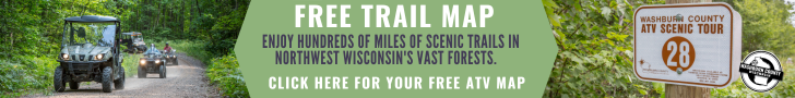
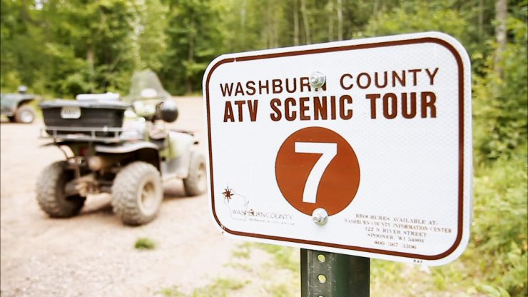
In addition to the county trail system, Washburn County is also home to two great state trails:

  • Wild Rivers State Trail, a 96 mile trail that follows an abandoned railroad grade. The trail is open to ATV use from Rice Lake to the southern edge of Superior where it connects with the Tri-County Corridor. 40 miles of the Wild Rivers Trail is located in Washburn County and goes directly through the communities of Sarona, Spooner, Trego and Minong. Parking areas exist in all four communities. In addition, Minong is home to the Wild Rivers Trail ATV Campground which offers 10 RV sites and 5 Tent sites.

  • Tuscobia State Trail, 74 mile trail that extends from Birchwood, through Sawyer County and ends up in Park Falls. From the Tuscobia, you can access the incredible Spider Lake Loop in Washburn County, head over to Sawyer for an afternoon of riding or make the trip over to Park Falls for a leisurely ride on the Tuscobia.

CLICK HERE TO VIEW MAPS OF THE WASHBURN COUNTY TRAILS

ATV Scenic Tour:

Washburn County has a fun new way to explore the area ATV trails. The Washburn County ATV Scenic Tour is now available for ATV enthusiasts to learn about over 35 points of interest located along the 100+ mile ATV system. If you have ever been riding on a trail and wondered what river you were passing by or what the giant fish along the trail represented, you’re in luck! The tour highlights waterways, natural points of interest, quirky landmarks and historical sites such as an old homestead where remnants of the original buildings still stand.

CLICK HERE TO VIEW THE ATV SCENIC TOUR BROCHURE


Rice Lake, Wisconsin


Area Information

Order your FREE Visitors Guide & ATV Trail Map ! – CLICK HERE


Barron County offers over 250 miles of groomed trails through some of the most beautiful north woods scenery you’ll find anywhere. The Tuscobia State Trail starts in Barron County and offers 76 more miles of groomed trails to Park Falls. The Wild Rivers Trail goes from Rice Lake’s north city limits 97 miles to Superior.

 
Wild Rivers Trail
The Wild Rivers Trail is a 96-mile multi-use recreational trail which travels along the abandoned Soo Line railroad grade. The trail meanders through Barron, Douglas and Washburn counties, and passes through numerous charming and unique northland communities. The trail is open 24/7/365 for ATVing!
 
Enjoy the beauty of the great outdoors while traveling the Wild Rivers Trail through northern Barron County. The trail begins within the City of Rice Lake. Points of access to the trail are located in the City of Rice Lake and at the junction of the Wild Rivers Trail and the Tuscobia State Trail just north of the city.  
 
Your travel along the Wild Rivers Trail follows a route laid out by early railroad companies dating back to the 1880s. Designated as a multi-use, four season trail, recreational activities allowed on the trail include ATVing, snowmobiling, walking, bicycling, running, horseback riding, snowshoeing, dog sledding and cross-country skiing.
 
While in Rice Lake, enjoy the natural beauty, lodging, shopping, dining and other recreational activities!


Tuscobia State Trail
A mix of history and scenic beauty, the Tuscobia State Trail is a 74-mile abandoned railroad grade, making it the longest state trail. Running through Barron, Washburn, Sawyer and Price Counties, you can find plenty of activities to keep you busy on the Tuscobia State Trail. This multi-use trail offers wonderful ATVing, as well as snowmobiling, hiking, canoeing, fishing and bird watching.
 
The western terminus is at Rice Lake in Barron County. From the western end to Angus, this stretch of the trail is part of the 1,000-mile Ice Age National Scenic Trail. Rice Lake provides users with a variety of amenities including trail parking, lodging, restaurants, retail and service establishments.
 
For more information, check out http://www.tuscobiatrail.com/ or call (800) 269-4505.
 
Click Here to see where Rice Lake & Barron County, WI is located.

Click Here to see the current weather forecast for Rice Lake & Barron County WI.


Price County, Wisconsin

Trail Conditions: Good

Date of Report: December 27, 2018

Area Report:

Flambeau Trail System (70 miles) ~ OPEN May 1 through March 15 – Report date 12/27/18 – OHV trails are open until spring break up, and everything should be pretty firm from the cold temps. There is very little snow on the ground. Trail manager – Chequamegon-Nicolet National Forest – 715-762-2461.

Georgetown Trail (15.8 miles) ~ OPEN May 1 through March 14 – Report date 12/27/18 – The Georgetown Trail is in good condition for ATV, UTV and Off-road Motorcycle riding. Trail manager – Price County Forestry & Parks Department – 715-339-6371.

Pine Line / Price-Taylor Rail Trail/Prentice Area ~ CLOSED – The Price County section of the trail allows ATV and UTV use December through March 31 when snowmobile trails are officially open and the temperature is 28 degrees or colder.


Area Information

Order your FREE Trail Map! – CLICK HERE


The Price County region of Wisconsin welcomes motorized vehicle enthusiasts to enjoy hundreds of miles of trail riding opportunities, events and the best in Northwoods hospitality. There are four trail systems in the county that are open spring through fall including 62-miles of the Tuscobia State Trail, the 70-mile Flambeau Trail System, the 9.5-mile Solberg Trail, and the 15.8-mile Georgetown Trail. Via the Tuscobia State Trail one can access the 38-mile Flambeau River State Forest Trail and the 56-mile Dead Horse Run Trail, both in neighboring Sawyer County. During the winter months, riders can use the Flambeau Trail System, Solberg, Georgetown, and the Pine Line Rail Trail with access to Timm’s Hill, Wisconsin’s highest geographical point, via club snowmobile trails with temperature restrictions enforced on some trails. Motorized vehicles are permitted to operate on designated streets in several communities allowing direct trail access to lodging, camping, restaurants, fuel and other services.

Park Falls Wisconsin serves as the trailhead for the Tuscobia State Trail, an abandoned railroad grade that offers ATV and UTV use on a 62-mile stretch from Park Falls west to Birchwood. Traveling along the multi-use trail you will encounter a variety of scenery from wooded sections to open farmland. The Park Falls-Tuscobia Trailhead County Park is the perfect location to begin your journey with ample 24-hour parking, a loading ramp, picnic area, pavilion, grills, and a flush toilet building that is open from mid-April to mid-October. The park is located 1 mile west of Park Falls off of County Road E. There is also trail access to the Tuscobia State Trail from Smith Lake County Park & Campground located 2 miles west of Park Falls off of County E at Omaha Road. At Smith Lake County Park & Campground there is ample parking, a loading ramp, pavilion, picnic tables, grills, fire rings, electricity, plus pressure water, flush toilets and a shower building which are operable mid-April thru mid-October. Along the trail you will find lodging, camping, restaurants, fuel and other services. The trail is open for use on the eastern 10 miles from April 16 to November 14 and west of Price County on 52 miles from December 10 – November 14.

Park Falls and Fifield, as well as the Pike-Round Lake area of Wisconsin, serve as the system trailheads for the Flambeau Trail System, a 70-mile trail that winds through the Chequamegon-Nicolet National Forest. This multi-use trail is developed for riding ATVs, UTVs and dirt bikes/motorcycles, mountain bikes, horses, hiking, snowshoeing, and snowmobiles. The trail features rolling terrain, tree-lined corridors and several points of interest including the Smith Rapids Covered Bridge, Sailor Lake Campground , Round Lake Logging Dam, and Camp Nine Springs. The trail allows access to the city of Park Falls and connects to the Tuscobia State Trail. The trail is open for motorized use May 1 thru March 14. There is parking with trail access in Park Falls and at several access points in between. Along the trail you will find lodging, camping, restaurants, fuel and other services.

The 9.5-mile Solberg Trail connects to the Flambeau Trail System at Sailor Lake Campground. This multi-use trail is developed for riding ATVs, UTVs, off-road motorcycles, mountain bikes, horses, hiking, and snowshoeing. The trail has a graveled surface, crosses numerous wooden boardwalks and meanders through a variety of different forest types. The trail is open for motorized use May 1 thru March 14. There is parking with a loading ramp and trail access about 6 miles northeast of Phillips on East Solberg Lake Road, at Solberg Lake Campground, where you can ride from your campsite, and from area businesses. Along the trail you will find lodging, camping, restaurants, and other services.

The Georgetown Trail is located on the Price County Forest west of Phillips, Wisconsin. The trail is 15.8 miles long with a gravel surface and meanders through a variety of forest types. There are no amenities at either of the parking areas or along the trail; however, there is road route access to businesses on both ends of the trail. The north parking area is located west of Phillips on Carpenter Creek Road. From Hwy. 13 in Phillips go 10 miles west on County Hwy. W and then about 1 mile south on Carpenter Creek Road. The south parking area is located on Fairview Road north of Kennan. From U.S. Hwy. 8 and County Hwy. J intersection, go west on U.S. Hwy 8 approximately 2 miles to Fairview Road, then north 3 miles on Fairview Road to the parking area. There is access to restaurants/taverns at the south end of the trail, but fuel is not available. The trail is open for motorized use May 15 thru November 15.

The southeastern portion of Price County offers riders the Pine Line Rail Trail. The 26 miles of trail takes ATV, UTV, and snowmobile riders through scenic terrain between Prentice in Price County and Medford in Taylor County. The Pine Line Rail Trail is open to ATV & UTV use when the trail is open to snowmobiles, typically from Mid-December to March 31. Timm’s Hill, the highest geographical point in the state, can be accessed by snowmobile trail 189. Temperatures must be 28º F or colder to ride ATVs or UTVs on the trail. Parking and services are available in Prentice.

West of Park Falls, in Sawyer County, you will find the 38-mile Flambeau River State Forest Trail consisting of snowmobile routes, forest roads and town roads. The Flambeau River State Forest trail system can be accessed from Park Falls by taking the Tuscobia State Trail west for 13 miles and then heading south. The trail is open for ATV & UTV use May 15 thru November 15. Limited services are available along the trail.

West of Park Falls Wisconsin, in Sawyer and Ashland counties, you will find the 56-mile Dead Horse Run ATV, UTV and Off-Road Motorcycle Trail winds through the Chequamegon-Nicolet National Forest. The Dead Horse Run Trail can be accessed from Park Falls by taking the Tuscobia State Trail west for 13 miles and then heading north. Facilities along the trail system are limited to parking, and riders are advised to be prepared with ample supplies prior to entering the trail system. The trail is open for ATV, UTV, and Off-road Motorcycle and dirt bike use May 1 thru March 14.

With over 180 miles of scenic trails and businesses dedicated to serving the ATV travelers’ needs, the Price County Wisconsin region is definitely a great choice for the off-road rider!

Price County Trail Links:


Merrill, Wisconsin


Area Information

Order your FREE Visitors Guide & ATV Trail Map ! – CLICK HERE


Welcome to the scenic Merrill Area, where outdoor opportunities abound including scenic ATV trails for your enjoyment. Our trails also link up with Langlade and Oneida County’s summer ATV trail system. Don’t miss outon the miles and miles of ATV trail riding! The Harrison Hills ATV Trail is on land owned and managed by Lincoln County and includes 50+ miles of picturesque summer trails. Along the trail, view glacial moraines and upland hardwoods. It passes near cedar swamps, small creeks and lakes. The terrain is rolling to very hilly. In the winter months, there are approximately 175 miles of groomed ATV trails. Both summer and winter ATV maps are available that explain in detail the trail routes and months of operation. The quality maps are only a phone call away – just dial 1-877-907-2757!

We invite you to begin your adventure in Merrill, where friendly folks are here to help make your stay most pleasurable. We are conveniently located on Highway 51 where our 3 motels can be found directly off of Exit #208. Before your journey, be sure to grab a bite to eat and pick up any last minute supplies at one of our local businesses, where you’ll be greeted with a smile. Trail access is less than 10 miles from our accommodations. There are six major parking areas which are plotted on the ATV trail map including directions. 

To plan your stay in the Merrill Area, call the Merrill Area Chamber of Commerce toll free at 1-877-907-2757, visit our website or pick up maps and guides from our 24-hour information foyer located at 705 North Center Avenue, Merrill.

Click Here to see the current weather forecast for Merrill, WI.


Order your FREE Visitors Guide & ATV Trail Map ! – CLICK HERE


Antigo | Langlade County, Wisconsin

Trail Conditions: Excellent

Date of Report: June 14, 2024

Area Report:

A NEW ATV/UTV TRAIL IN LANGLADE COUNTY OPENS TO PUBLIC USE ON JUNE 15, AT 6:00 AM. THE NEW TRAIL IS LOCATED ALONG HIGHWAY 55 AND CONNECTS COUNTY ROAD WW AND COUNTY ROAD M. CLICK HERE TO VIEW A MAP DEPICTING THE NEW TRAIL. THIS TRAIL AND EXISTING ROAD ROUTES CONNECT THE LANGLADE AND OCONTO COUNTY TRAIL SYSTEMS AND PROVIDES ACCESS TO THE VILLAGE OF WHITE LAKE FROM THE SOUTH AND EAST.

PLEASE RESPECT THE ADJACENT LANDOWNERS AND REMAIN ON THE TRAIL. ALSO, USE REASONABLE SPEEDS ON THE ROADWAYS AUTHORIZED AND YIELD TO MOTOR VEHICLES WHEN YOUR SPEED MAY LIMIT THEIR USE OF THE ROADWAYS.

As a reminder all Langlade County Highway road routes are open year-round with ATV/UTV speeds allowed the same as vehicle traffic or as posted by ATV.UTV speed signs.

For more information, please contact Al Murray, Forest Administrator, or Cody Brauner, Langlade County ATV Coordinator at 715-627-6300.

The Langlade County ATV clubs, sponsors, and operators of the existing trails have put in many volunteered hours brushing and signing to provide ATV/UTV trails for your use. Please support the ATV clubs, thank them for their efforts, and patronize their business sponsors.

For additional information on Langlade County Trails please see the Forestry, Parks and Recreation Department website at www.langladeforestryandparks.com or on this website by clicking here.

For questions regarding specific trail conditions please contact the local ATV club or visit their social media pages.

Thank you for supporting the economy and businesses of Langlade County!

Al Murray
Langlade County Forest Administrator


Area Information

Langlade County Forestry and Recreation Dept.

1633 Neva Road
Antigo, WI 54409
715-627-6300

Click Here to see the current weather forecast for Langlade County, WI


These trails are mostly on land owned and managed by Langlade County. Trails were developed and are maintained by Langlade County with the exception of private property which is maintained by local clubs. There are over 93 miles of trail connected by several routes. The trail is very scenic and transverses glacial moraines, upland hardwoods, cedar swamps and small rivers and lakes. The terrain is slightly rolling to very hilly, and links to the Lincoln, Oneida, Oconto, and Forest County  ATV trails.

The trails open with weather permitting after May 1st and close December 1st.

For further updates or questions regarding the trails you may call the Langlade County Forestry and Recreation Department at 715-627-6300 or visit the website at: www.langladecounty.org or request a free Langlade County ATV map by clicking here


Trail Access

  1. Parrish Highland Trail Area

-Hwy Q, at the Oneida/Langlade County Line

-Hwy H, 2 miles south of Hwys 17 & Q

-Hwy T, 3 miles west of Hwy 45, Summit Lake

  1. Augustyn Springs Trail Area

-Hwy. A, 8 miles northeast of Neva from Hwy 45

  1. White Lake Trail Area

-Sherry Road, 1.25 miles north of Hwy 64, Polar

-Hwy M/Maple Street, downtown White Lake

Trail Regulations

The Langlade County ATV trail system is a two-way trail. It is located on existing logging roads which are open to motor vehicle traffic, licensed vehicles and many other recreationalists. Off trail riding is strictly prohibited; this includes any forest road that is gated, cabled, posed, ditched or signed prohibiting the travel of unauthorized vehicles. Side-by-side vehicles or UTVs and LUVs such as: mules, gators, rangers, rhinos and prowlers will be allowed on Langlade County trails and forest roads. ATVs with stuffed tires or chains are prohibited. Also, ATVs are not allowed on the Ice Age Hiking Trails. The trail can be recognized with yellow paint on the trees adjacent to the trail. The ATV trails are marked by orange trailblazers/brown ATV signs. Please use caution and appropriate speed.  Langlade County ATV trail system does require users to display either a Wisconsin registration or an ATV trail pass.  Click here  for more information. 

ATVs are allowed on state-funded snowmobile trails, but only after 10 days after the trails officially open and when temperatures are under 28°F.

Roads

ATVs are allowed to operate on designated county highway year-round, as well as county or town roads designated by green routes signs. Highway regulations must be followed on all ATV routes.

Camping / Hotels / Cabins / Resorts

Camping on the Langlade County forest is allowed for up to 14 days, except in parking areas and areas posted prohibiting it. There are also several campgrounds, resorts and motels throughout Langlade County.   For a list of ATV/UTV friendly campgrounds in Langlade County, click here  For information on other accommodations besides camping click here.

Services

Several food and gas stops are available along the trail and on connecting routes.

Timber Harvesting

The Langlade County Forest is over 127,000 acres in size and is managed primarily for timber production, together with providing recreational wildlife, and other multiple use benefits. You may encounter some logging activity. Please use caution and respect the loggers’ equipment as they earn their livelihood.

Invasive Species

Please assist us in slowing the spread of invasive species on the forest by washing your machines before and after riding on Langlade County’s ATV trails. There are washing stations located at the Hwy T parking area west of Summit Lake and Augustyn Springs will be getting a wash station by the end of 2017 at the trailhead/parking area on Highway A.

Please respect the forest. Don’t litter or harass wildlife. We hope you enjoy what Langlade County has to offer, and that you’ll have a memorable riding experience in the County of Trails.

Summer Information

The Summer ATV Trails will be closed from December 1 – May 1, weather permitting.

Winter Information

In the winter, ATV’s are permitted on approximately 500 miles of the funded snowmobile trails, EXCEPT on the Nicolet National Forest, and areas that are posted NO ATVs. However, ATVs are not allowed on the trail until 10 days after the snowmobile trails have officially opened and the temperature is less than 28 degrees Fahrenheit at a point four feet above the trail surface. 

For more information on ATV/UTVing in Langlade County: The County of Trails, go to www.langladecounty.org.


Iron River, Wisconsin


Area Information

Notice: Not all snowmobile routes are open to ATVs.  Click here for a current map.


Welcome to Iron River, Wisconsin, the hub of ATVing in Bayfield County. Iron River is the intersection of a number of major trails in the county with the Tri County Corridor running right through the town, providing easy access to lodging, fuel, food and entertainment. 

Come enjoy the beauty of the Chequamegon National Forest. With over 500 miles of trails to explore, you are sure to have a good time.  
  • The Battle Axe (Trail # 3) starts just east of town.  It is the beginning of a 90+ mile loop around the gorgeous Chequamegon National Forest.  The breath taking view of Old Baldy can be seen from the Battle Axe Trail. 
  • Take the Wally Polk Memorial Trail (Trail #40) to Port Wing and follow the route through town to see and smell the cool, peacefulness of Lake Superior. 
  • There is access to Herbster from the Leanne Trail (Trail #1) 
  • Visit the Valhalla Overlook for a view from an old ski lift along the beautiful Valhalla Trail (Trail #31).  Washburn can be accessed for the top of the Valhalla Trail.  Ashland can be accessed via the Moquah Spur (Trail #63) and the Tri-County Corridor (#2).  Follow the scenic Iron River Trail back to Iron River. 
  • Following Trail #31 south from the Tri-County Corridor will take you on a loop to Delta. Visit several resorts and wonderful restaurants along the way. 
  • Heading west from Iron River you can take the Lake Ameek (Trail #24), Bear Paw (#7), Buckskin (#31) and Horse Pasture Grade (#6) for a 60+ mile loop to Drummond and back. You’ll travel beautiful an Aspen forest and a Ruffed Grouse habitat reserve. Don’t forget to visit The Bear Creek Falls along the way.  You can take the left fork and visit Barnes too. 

Many of the county’s trails lead to adjoining trails in neighboring counties such as Ashland, Price and Douglas. Come see what the snowmobile trails like during the other three seasons!
 
Ride your ATV from your door to the Trails at most lodging facilities. Visit our website for lodging information.
 
Click Here to see where Iron River, WI is located.

Click Here to see the current weather forecast for Iron River, WI


Hurley, Wisconsin


Area Information


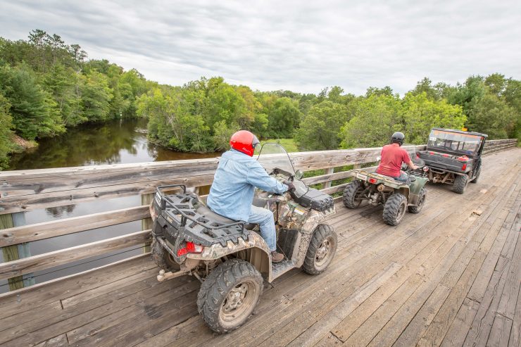
Beautiful places, friendly faces….

It’s not just the trails that will keep you coming back, it’s the land, water and people too.  Excellent and plentiful trails await you.  Over 50 pit stops are waiting along the Iron County trail system to welcome riders in for refreshments, food and good company.  Plenty of spots offer pumps for refueling once guests are ready to hit the trails again!

More trails for more adventure…
Explore more that 200 miles of 4 season trails in Iron County alone.  More than any other area in the Midwest!  Our scenic area offers just about everything that off-road enthusiasts are looking for. 

More to do on our trails…
The Iron County trail system offers some of the most beautiful scenic vistas you will ever experience.  Five of Wisconsin’s 10 highest waterfalls lie within Iron County and several are accessible or within a short distance by trail.  Inland lakes are concentrated in the Mercer area and the biggest lake of them all, Lake Superior, awaits you by trail just north of Hurley.  The Penokee Mountains, the Northern Highlands and nearly a million acres of forests offer you terrain unlike anything else in the state.  Our thick forests provide a haven for wildlife, as you’ll see frequently when you ride our trails.

Hurley is quickly developing a reputation as a great spring, summer and fall getaway.  Hurley’s close proximity to Lake Superior is another major attraction to the area.  Charter fishing, kayaking and camping opportunities abound. 

Famous Rallys…. May and October
Iron county hosts the Annual Memorial Weekend ATV Rally in the spring.  The popular rally attracts thousands of ATVers each year and features a great poker run, an ATV parade and lots of other fun-filled events and activities.  In the fall we also have the Annual Pumpkin Run ATV Rally, featuring many of the same activates, complimented by the area’s beautiful fall colors!


Florence, Wisconsin

Trail Conditions: Good

Date of Report: June 27, 2024

Area Report:

Trails are in good shape.  We’ve had a lot of rain so mud puddles are frequent for those who prefer mud over dust.  Nice weather now so plan a trip to Florence County!

News and Reports:

ATV/UTV routes update: the County Board approved that County Hwy D is now open from County Hwy N to State Hwy 101. County Hwy N is now open from US 2 south 1,500 feet to the old RR Grade Corridor trail.


Area Information


Florence County maintains easily accessible trails through a variety of forested and open areas, offering scenic views found only in the Northwoods.  We offer 160 miles of ATV/UTV trails and routes connecting to more trails in adjacent Wisconsin counties and Upper Michigan. 

Our local club, The Blue Ox Trail Riders, does a great job maintaining and signing the trails receiving a 5-star rating from those who use the trail system regularly.  The northern part of the Nicolet State Trail runs through the western portion of Florence County connecting to Forest and Oconto counties as well as Michigan. 

Club Website:  www.BlueOxTrailRiders.org  To order a Blue Ox ATV/Snowmobile Trail Map call the Florence County Visitor Center at 715-528-5377 or send an email with your mailing address to info@FlorenceCountyWI.gov.

The Florence County trail system offers trailside lodging and dining opportunities as well as friendly pit stops that supply food, drink and gas. Riders take short hikes to see waterfalls, several scenic overlooks, campgrounds, lakes, beaches and parks.

 Florence County also offers a 17-acre ATV park located on the south side of Fisher Lake in the Town of Florence.  This course was designed for riders who want to go off trail to “rip it up” in the dirt and mud.
 ATV/UTV operation is allowed on designated trails and routes that are marked with state approved brown and white 6”x 6” ATV trail signs.  Townships throughout the county have also designated road routes which are marked with signs providing additional access points to businesses and the local trail system.  You can ride the trails all winter when the temperature is below 28 F.

 Our trails do close during the spring “Break-Up” season for a few weeks to prevent erosion of the trail base.   Trail closures are always posted on our website www.ExploreFlorenceCounty.com as well as on our Florence County Facebook page.