Your Online Trail Report and Travel Guide for ATVs the U.S. & Canada
Your Online Trail and Travel Guide for ATV the U.S. & Canada

Reporter Areas

Mercer, Wisconsin


Area Information


Four Season Riding

The Iron County Forest is open for ATV/UTV adventure in all four seasons. Typically, the ATV/UTV trails are open from mid-May through March 31 or when the trails close for the winter season. In the winter, ATVs and UTVs are allowed on the trails when the temperature is 32 degrees or colder. Winter trails are available through the cooperation of the White Thunder Riders and the Mercer Sno Goers.

ATV/UTV Trail

Things to know and tips to be aware of:

  • Hours of ATV adventures and camaraderie in one of Wisconsin’s most picturesque settings
  • 120 miles of well-maintained Iron County Forest trails, with access to hundreds of miles of routes in Vilas, Price, and Ashland County, Wisconsin, and the Upper Peninsula, Michigan
  • Waterfall viewing and scenic overlooks
  • Well-marked trails winding through forest and fields
  • Local bars, gas stations, lodging, and restaurants on ATV routes and town roads open to ATV traffic
  • Day parking for trailers is available near the railroad grade in downtown Mercer off Trail 17
  • All children under the age of 18 must have a minimum DOT Standard motorcycle or ATV helmet. Bicycle helmets are NOT legal.
  • Visit GoWild.wi.gov for information on regulations, licenses and trail passes.


St Germain, Wisconsin


Area Information


Nestled amidst the picturesque landscapes of northern Wisconsin, the quaint town of St. Germain is a hidden gem for nature enthusiasts and adventure seekers. While the region is renowned for its pristine lakes, lush forests, and vibrant wildlife, it also boasts a network of exhilarating ATV trails that offer a unique way to experience the area’s natural beauty. Whether you’re an avid off-roader or a curious traveler looking to immerse yourself in the great outdoors, St. Germain’s ATV trails are sure to captivate your senses and leave you with unforgettable memories.

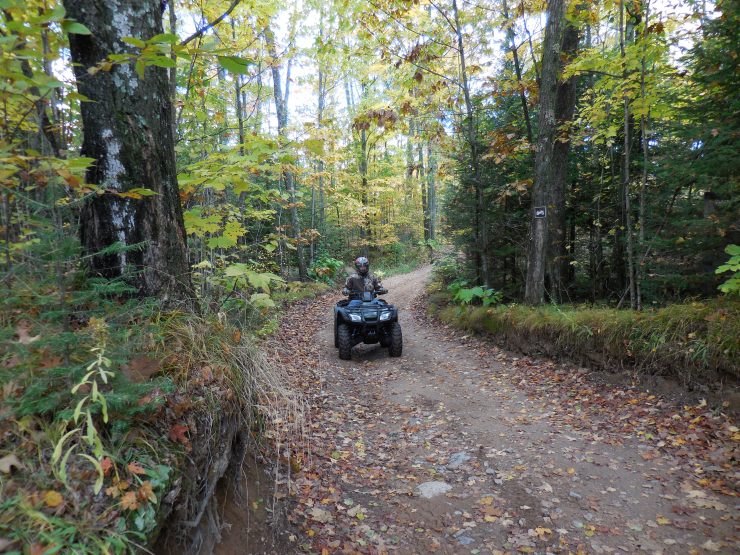
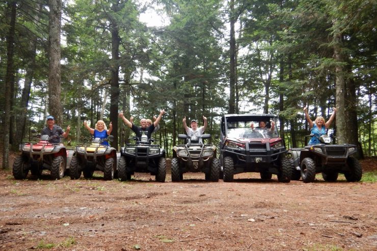
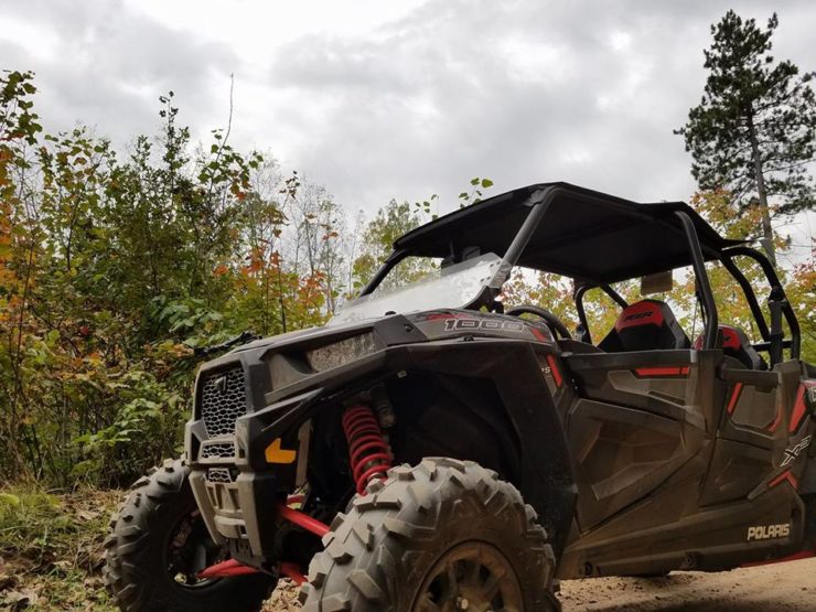
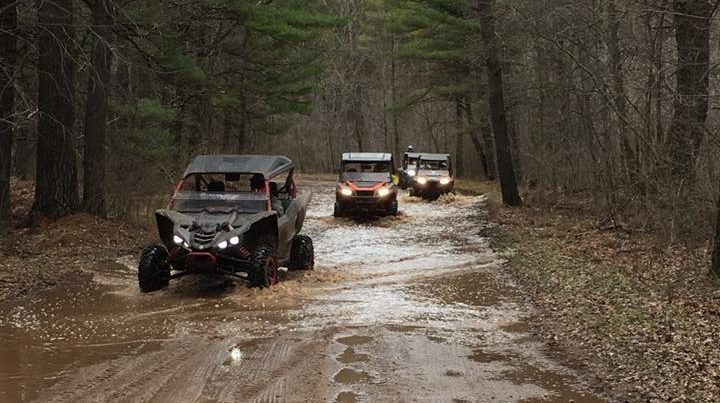
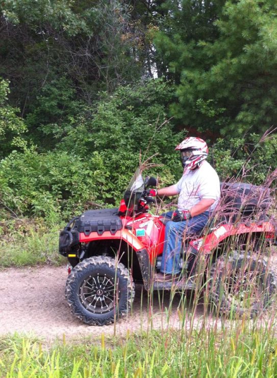
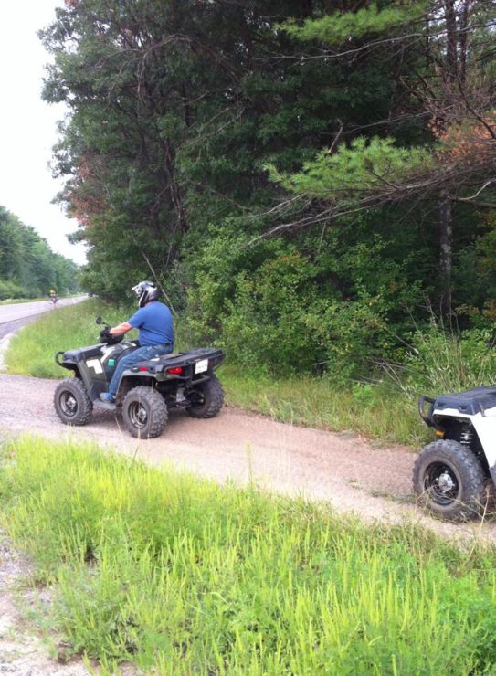
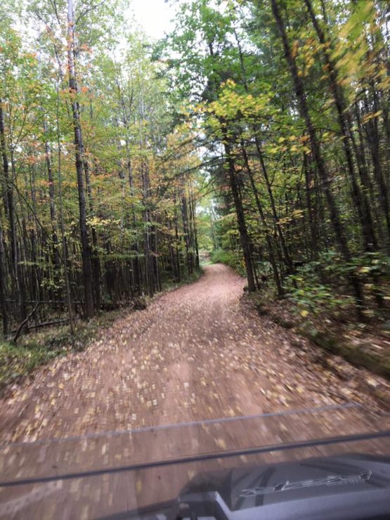
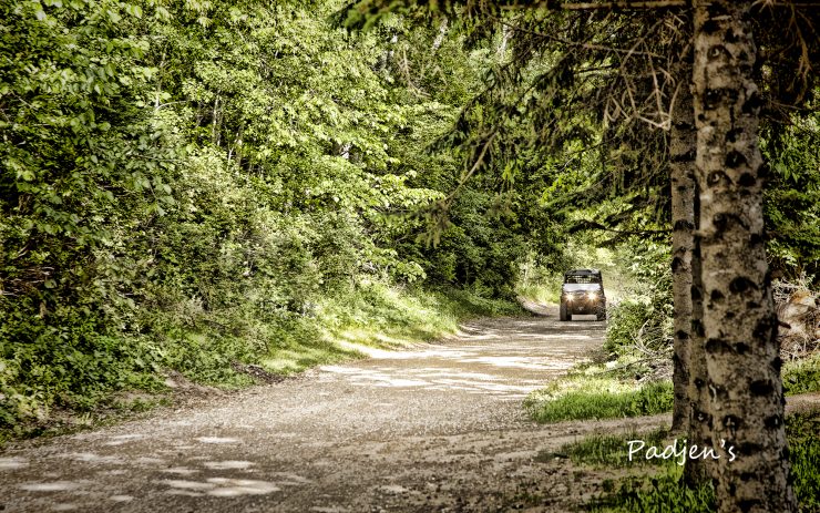
St. Germain’s ATV trail system encompasses a vast expanse of rugged terrain, meandering through dense forests, rolling hills, and sprawling meadows. With over 100 miles of well-maintained trails, riders of all skill levels can find routes that cater to their preferences and abilities. From leisurely scenic rides to challenging off-road adventures, there’s something for everyone.

One of the remarkable aspects of St. Germain’s ATV trails is their integration with the region’s pristine natural surroundings. As you traverse the trails, you’ll find yourself immersed in a breathtaking tapestry of colors, sounds, and scents. Towering pines whisper in the wind, while vibrant wildflowers dot the landscape, painting the scenery with splashes of red, yellow, and purple. The trails wind alongside sparkling lakes, allowing riders to catch glimpses of wildlife like majestic bald eagles soaring overhead or deer grazing by the water’s edge. It’s an immersive experience that connects you to the heart of nature and reminds you of the beauty that lies just beyond the beaten path.

In addition to the awe-inspiring natural beauty, St. Germain’s ATV trails offer a wide range of recreational opportunities. Along the way, you’ll find picnic areas, scenic viewpoints, and rest stops where you can take a break, refuel, and soak in the surroundings. The trails also connect to other attractions in the area, including charming small towns, historical sites, and inviting local eateries. Exploring St. Germain’s ATV trails is not just about the thrill of off-roading; it’s about discovering the unique blend of nature, culture, and adventure that defines this remarkable corner of Wisconsin.

It’s worth noting that the town of St. Germain takes great pride in preserving its natural resources and promoting responsible ATV trail use. To ensure the sustainability of the trails and the protection of the environment, riders are encouraged to adhere to the established guidelines and regulations. These include staying on designated trails, respecting private property boundaries, and avoiding sensitive ecological areas. By practicing responsible ATV riding, visitors can contribute to the long-term preservation of St. Germain’s natural wonders, allowing future generations to enjoy the same captivating experiences.

Whether you’re a nature enthusiast seeking serenity or an adrenaline junkie craving an off-road adventure, St. Germain’s ATV trails provide the perfect blend of excitement and natural beauty. As you explore this enchanting region, you’ll discover that the trails offer more than just a thrilling ride—they offer an intimate connection with the natural world. So, grab your helmet, hop on your ATV, and embark on an unforgettable journey through St. Germain’s ATV trails, where the wonders of nature await at every turn.
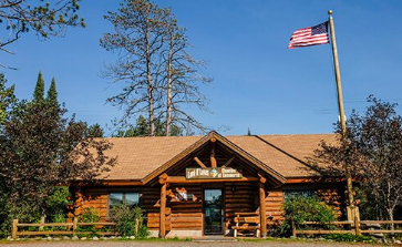

Stoughton, Wisconsin


Area Information

To download a atv application please go to Dane County Parks


Stoughton is one of the well-known atv trails of southern Wisconsin. A charming city located within Dane County is one of the favored trails for Midwesterners. With an average of 41 inches of snow every year, Stoughton has proved to be a favorable place for atv to enjoy their sport. Amongst its trails, Stoughton is known for its trail systems named as The Yahara River Trail, skirting the Yahara River and the Virgin Lake Trail which connects the Virgin Lake Park to the Jackson Street.

Stoughton has had a variery of local clubs formed by the local families since 1969 these are some of the oldest in South-west Wisconsin.  While the safety is observed at all the levels, you do need to have a valid safety license in order to atv through the trails. Oregon, Utica, Waubesa and Rock County are some of the places that are connected to Stoughton through these public trails.

The local clubs maintain the 38 miles of public trails that connect atvers from Oregon, Utica, Waubesa and Rock County. Stoughton is a haven for ATV sports and adventure lovers. So hurry up and plan your summer fun with Stoughton this year!

All-terrain and commercial vehicle driving is a growing sport in Wisconsin, and the privilege of enjoying it comes with the responsibility of ensuring that you operate your vehicle safely and responsibly.

DNR Conservation Wardens recommend that all ATV / UTV operators complete a safety course at least once a year for the first two years of operation. All ATVs and UV operators born after January 1, 1988 must complete an instructor course at age 12 and 16 years or older to operate their vehicles in the state of Wisconsin.

A Wisconsin atv registration or atv trail pass are required to ride on a Wisconsin arv trail. Trail passes may be purchased over the counter at many authorized sales locations or by contacting WDNR.  Knowing the atv regulations, rules and registration information will help ensure a safe trip. Wisconsin Department of Natural Resources – www.dnr.wi.gov  


Crivitz, Wisconsin


Area Information

For more information or events: www.IronSnowShoe.com    1-844-CRIVITZ


The ATV/UTV riding has become an exciting recreational sport for many in the state of Wisconsin.  There is no better way to immerse yourself in this outdoor paradise then to “hit the trails”.  Crivitz and The Iron Snow Shoe Recreational Trails are located in northeast Wisconsin, Marinette County.  We have hundreds of miles of ATV/UTV trails weaving throughout the northwoods forest which translates to a riding adventure for all.

The beautiful Marinette County Forest encompasses 230,000 acres. Within the forest are wild rivers which offer fourteen major waterfalls.  Most of these waterfalls are at county parks.  Some of the parks have picnic areas and are ATV/UTV friendly with trail access to campgrounds.

Our well groomed trails stretch from the Nicolet National Forest to Crivitz which includes: Twin Bridges, High Falls Flowage, Caldron Falls Flowage, Silver Cliff, Thunder Mountain and Crooked Lake areas of northeastern Wisconsin.  

No matter which loop or trail you ride, you won’t be disappointed.  Riders will have access to county forestland, rolling hills, twisty trails, sandy flats, forest roads and waterfalls.  

The friendly business owners on the Iron Snow Shoe Recreational Trails offer gas, food, and lodging right on the trail.  Northwoods hospitably is hard to beat and adds to your adventure.  See you on the trails.


Black River Falls, Wisconsin


Area Information


The ATV trail system is open from May 15 to October 15 and December 15 to March 15.  It may shut down at any time due to conditions.

Jackson County has some of the most popular ATV trails in the Midwest. Over 100 miles of trails wind through the scenic Black River State Forest and Jackson County Forest. All trails are clearly marked. No “off-trail” riding is permitted in Jackson County.

Parking lots for trail access are located at the following areas

  • Highway 12, West of Millston.
  • Junction of County O and North Settlement Road, East of Millston.
  • Highway 54, East of Black River Falls,WI.
  • West Clay School Road, near East Arbutus.
  • Ott Trail Parking Lot, Airport Road, East of Black River Falls,WI
  • Crawford Hills and East Arbutus Campground.

ATV Registration Information

Wisconsin Law requires that all non-resident (out of state) ATV’s purchase a non-resident trail pass. These passes are available at any location that advertises the sale of hunting/fishing licenses.

All-Terrain Vehicle (ATV) Registration Application Form 9400-376 (PDF 216KB)

Jackson County ATV Map (Adobe PDF 1.42Mb)

  • All motorcycles using the trail system must have a Jackson County sticker and be licensed.
  • Over 8 miles of single track motorcycle trails. (Off road motorcycles can only operate on the single track trails.)
  • All ATV trails are marked with orange posts and blazes.
  • All ATVs must have a state registration sticker, not a Jackson County motorcycle sticker.
  • Warning: Motorcycles and ATVs are prohibited in areas posted with the symbol x. Violations will result in the issuance of citations.
  • When operating near a dwelling or residential area, or passing a pedestrian or horseback rider, the speed limit shall not exceed 10 MPH


Land O Lakes, Wisconsin


Area Information


Ride the many miles of scenic trails and roads to get an up close view of our beautiful Northwoods and many lakes with the Vilas County system of ATV/UTV trails and routes. These routes connect Land O Lakes, Conover, Phelps and Eagle River to Forest and Oneida counties and the UP networks of trails. While taking in all of the natural sights, maybe you would like to stop in at our local shops, pubs or restaurants many of which have local historical significance. Of course after a long day of sight-seeing you’ll want to cozy up into one of the areas beautiful lodging offerings.

Trail maps are available upon request via the Landover website, www.landoveratv.com, the Land O Lakes Chamber of Commerce http://www.landolakes-wi.org/ and other area businesses.

New trails have opened up in the Land O Lakes area!

From Hwy 45 on Cty Hwy B has opened up to Little Portage Lake Rd, from Little Portage Lake Rd the trail then connects to Rummels Rd andthe Rummels Rd trail connects to the Conover system.


Rhinelander/Oneida County, Wisconsin


Area Information


Oneida County ATV trails are open from May 22 to December 2.

  • Oneida County’s ATV trails are located in the southwestern part of the county. The Lynne/Little Rice Lake ATV trail system offers plenty of stops along the way, making it a great destination for group and family rides.  The Enterprise ATV trail system includes a campground and picnic shelter.
  • In addition to these two trails, there are approximately 200 miles of woodland trails that are open to all motorized vehicles year-round. During the winter, ATVs are not permitted on trails maintained for skiing and/or snowmobiling.
  • All County Forest ATV gates have been retrofitted to allow UTVs up to 65 inches wide.

Little Rice ATV Trail   Map

  • The Lynne/Little Rice ATV Trail system is located in southwestern Oneida County. This trail system consists of 16 miles of woods trail, 23 miles of connecting ATV road routes and 76 miles of town roads open to ATV use.

Enterprise ATV Trail   Map

  • The Enterprise ATV Trail consists of 10 miles of trail (16 miles round trip) located entirely on Oneida County Forest. The trail links up with Langlade County trails to the south and Lincoln County trails to the west. A campground and picnic shelter with restrooms & water is located in the central part of the trail system

Enterprise Campground    ATV Campground Map

  • The Enterprise Campground is located within the Oneida County Forest approximately 11 miles south of Rhinelander on Shingle Mill Rd. The campground is accessible via the Enterprise ATV trail or via Shingle Mill Rd. There are 11 campsites with grills, fire rings and picnic tables. Restrooms and hand pump wells are also provided. Fees are $10/night per site and are payable by self-registration.
  • The campground is open from May 22 until December 1.

Link to ATV Regulations in Oneida County


Oconto County, Wisconsin


Area Information


Oconto County ATV/UTV trail system is over 450 miles of fully interconnected scenic riding. We are less than a full tank of gas round trip from the Fox Cities/Green Bay area and less than a three hour drive from the Milwaukee area. Trails open the last weekend in April and close the first Sunday in November. Dates are subject to change depending on weather and trails conditions. For current trail conditions go to www.ocontocounty.org for more information.


The Oconto County ATV/UTV trail system runs through the Chequamegon-Nicolet National Forest and connects to various other counties and Michigan.

For your convenience, trailheads have been strategically placed throughout the county. Trailheads are located near the Hwy 32/64 intersection, just East of Chute Pond, in Gillett at Zippel Park, in Suring near the Village Hall, and in Lakewood on Hwy 32.
For trail conditions or questions please call 1-888-626-6862. To request a free Oconto County ATV/UTV map go to www.ocontocounty.org.
Happy Trail Riding!


Cheboygan, Michigan


Area Information


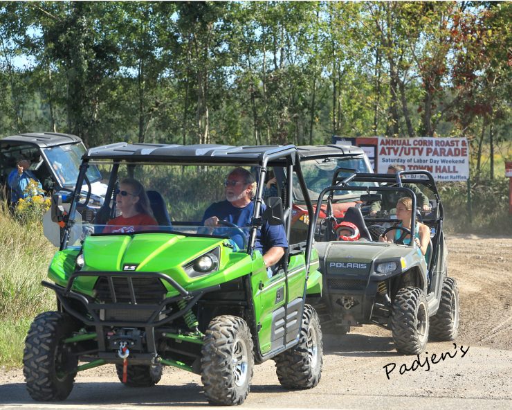
 With hundreds of miles of marked trails, there is no better place for a quad ride or motocrossing! Our hundreds of miles of seasonal roads, the famous Scramble and the entire Black Mountain Recreation Area, our deep woods and forests with signposts along the way through wilderness and villages and towns, they all beckon.

The Cheboygan area has more to offer all terrain ORV enthusiasts than any Northern Michigan vacation destination.. We have more miles of groomed trails, more miles of accessible park trails and public land with logging trails, more of everything an adventurous rider and his family could want! Call or stop by the Cheboygan Area Chamber of Commerce office in downtown Cheboygan and we’ll steer you in the right direction.


At the confluence of the Cheboygan River and Lake Huron sits a community far and away from the hustle and bustle of everyday life. Located on the picturesque Straits of Mackinac, Cheboygan is the gateway to the famous Inland Waterway a navigable series of waterways encompassing three rivers and three lakes and 42 miles of inland boating pleasure. A cruise from the mouth of the Cheboygan River into Lake Huron can take you to Bois Blanc or Mackinac Islands, both a leisurely boat ride away.Motor Cross Cheboygan Michigan

The area is also home to trailheads for the North Central State Trail and Cheboygan to Alpena Trail, former railroad lines that have been converted to pedestrian use in the warmer months and snowmobile trails for the winter.

For lighthouse seekers, Cheboygan is home to two of its own, plus two more easily visible from our beautiful city beach on Lake Huron. Three more lighthouses are thirty minutes or less away, and most are open to tours. Cheboygan is also the home port of the Coast Guard Cutter Mackinaw.

Cheboygan offers opportunities for fishing, hiking, cross country skiing, kayaking, hunting, and numerous other outdoor activities. For those that prefer to stay indoors, our local merchants will warmly welcome you to a variety of novelty shops, retail outlets, entertainment facilities, casual and fine dining, and much more.

You will find that our way of life here is warm, genteel, and inviting. Locals will be glad to show you around, give you recommendations, and make your experience memorable. Base your up north vacation here and be in the center of all that the area has to offer.

The Cheboygan Area Chamber of Commerce and our member businesses work hard every day to provide you with the goods and services you need while in our area  whether you are here for a day or a lifetime. The Chamber is here to assist you in whatever your needs in our community may be.


Watersmeet, Michigan


Area Information


Order your FREE Visitors Guide & ATV Trail Map! – CLICK HERE

The Watersmeet Chamber of Commerce invites you to visit our beautiful area for your next ATV/UTV trip. Our east/west trail connects with the Marenisco and Iron River trails. It’s wide and in great shape since it serves as one of our winter snowmobile trails. 

The Forest Service trails also cover the whole township of Watersmeet. Travel through our beautiful forests, over wooden bridges, and past all kinds of waters. Enjoy the colorful northwoods with its awesome scenery and abundance of wildlife.  Many trails are not limited to 50″ wide vehicles. 

County road shoulders can be legally driven on with ATVs to pick up the main trails and many of the fringe trails.  Accomodations in our area range from small motels and a small historic hotel to a large casino hotel with 132 rooms.  There are a number of resorts and private vacation homes on the Cisco Chain, Lac Vieux Desert, and Crooked Lake.  With accommodations varying from small cabins for two to large homes with plenty of amenities for big groups, you’ll be sure to find something to fit all your needs in Watersmeet.   Camping is also available from primitive camping to a public campground. We have two ATV/snowmobile businesses here for sales and service who can help with all your needs.  Restaurants, cafes, bars, gas stations, grocery and convenience stores, as well as a casino are right here to serve you as well.

A spring trip brings rushing waters from the winter thaws. As the woods awakens after a blanket of ten or more feet of annual snow, the new flora and fauna come alive. The trees are budding, rivers and streams are flowing, and the wildlife is everywhere to be seen.
 
During the summer, when there are more people around, trails still aren’t busy. It’s one of the joys of life in the northwoods.  Trees and wild flowers are in full bloom, and it’s a beautiful time to visit. Besides siteseeing, you might want to spend some time on one or more of the scenic lakes or rivers. Boating and fishing here are just a couple of the bonuses of planning an ATV trip here.

The trees start putting on their magnificent fall colors as early as later August and continue into October. It’s a quieter time for the great northwoods, but it’s also an absolutely awe-inspiring time to be in the Watersmeet area. The sites, the sounds, the smells and the quietness or the exhilaration of the area are all yours for the taking. 

As fall turns into winter and snowmobiles replace ATVs on the trails, don’t forget Watersmeet for some of the best snow and groomed trails anywhere. 

Whenever you choose to travel here, you’ll long remember the trails, the scenery, and the warm-hearted people in Watersmeet. You’ll take home wonderful memories to relive for years to come. We hope you’ll return time after time to enjoy our terrific ATV and snowmobile trails. 

To download Michigan DNR maps, please visit www.michigan.gov/dnr. The Forest Service has three huge maps of ATV trails for our area, too. You may contact the Forest Service at 906-358-4551 or visit their website at www.fs.fed.us/r9/ottawa for additional information. The MI-Trale Western Upper Peninsula ORV maps are available at Headwaters Polaris and Rogers’ Bar in Watersmeet.